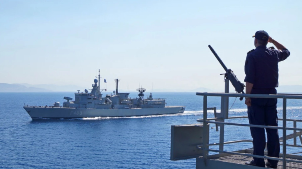


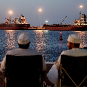
Greece made headlines yesterday with the long-anticipated announcement of its first-ever Maritime Spatial Plan, a move that sets the framework for organizing its maritime space. While the government hails it as a major step forward, the opposition criticizes the delay, claiming it should have been done years ago.
But what exactly is maritime spatial planning, and why is it so significant — not just environmentally, but geopolitically? Here’s a breakdown of what this plan means, why it matters, and what to expect next.
What is Maritime Spatial Planning (MSP)?
At its core, Maritime Spatial Planning (MSP) is about mapping and regulating human activities in the sea — from fishing and shipping to renewable energy and environmental protection — in a way that ensures the sustainable development of marine areas.
In Greece’s case, the plan covers all national maritime zones, outlining what activities can happen where, and how they can coexist with each other and the environment. It balances economic development with ecological protection, in line with EU legislation (Directive 2014/89/EU) and international maritime law, particularly the United Nations Convention on the Law of the Sea (UNCLOS).
By implementing MSP, Greece also fulfills a critical European legal obligation, while aligning itself with broader initiatives like the European Green Deal, which promotes a sustainable blue economy, the conservation of biodiversity, and the protection of marine ecosystems.
What’s the Goal?
The primary aim is to coordinate land-based and sea-based activities smoothly, ensuring that economic, ecological, and social interests do not clash but support each other.
As Greece’s Ministry of Energy puts it, “Maritime spatial planning allows for a coordinated — rather than fragmented — approach to regulating human activities at sea.” This holistic strategy provides the foundation for developing a blue and circular economy, one that uses marine resources wisely and sustainably.
Why Is It Important?
This plan marks the first official EU-recognized document that defines the outermost potential boundaries of Greece’s continental shelf — including both its mainland and islands — in maritime zones.
To date, only Greece and Croatia among EU member states had failed to submit such a plan. With this move, Greece not only catches up but also stakes its claim over its maritime zones more clearly — something with potential geopolitical ramifications, especially in contested waters.
In a joint statement, Foreign Minister Giorgos Gerapetritis and Environment and Energy Minister Stavros Papastavrou called it a landmark initiative: “For the first time, Greece is setting the rules for organizing its maritime space. This plan provides a comprehensive framework for sustainable development while clearly mapping human activities in our seas, always with respect for environmental protection.”
Why the Delay?
The opposition has slammed the government for dragging its feet. According to EU law, Greece was supposed to submit its plan by March 21, 2021. It missed the deadline by four years, and the European Court of Justice officially condemned Greece for this delay on February 27, 2025.
Does This Define Greece’s EEZ (Exclusive Economic Zone)?
No — and this is an important distinction. While the MSP does map out potential uses of Greek maritime areas, it is not a legal delimitation of the EEZ.
The Greek Ministry of Foreign Affairs clarified: “The process of delimiting maritime zones — like the EEZ — is distinct from maritime spatial planning. MSP is about how a country organizes human activity within its maritime zones to meet environmental, economic, and social goals. It does not constitute or replace official boundary agreements.”
How Has Turkey Responded?
Though Greek officials seem cautiously optimistic that Turkey will not escalate tensions over this, Ankara has already issued a formal response, accusing Greece of taking “unilateral actions” in a “closed or semi-closed sea” like the Aegean and Eastern Mediterranean.
Just before Greece’s announcement, Turkey’s National Center for the Sea and Maritime Law (DEHUKAM) published its own academic framework for Turkey’s maritime spatial planning. DEHUKAM’s statement stressed that the Turkish initiative aims to reinforce the strategic vision of the “Blue Homeland” doctrine, and to organize Turkey’s maritime activities within an environmentally responsible framework.
Despite the political undercurrents, diplomatic channels remain open. The scheduled meeting between Greek Foreign Minister Gerapetritis and his Turkish counterpart Hakan Fidan, set for mid-May, is still expected to go ahead as planned.
Source: Tovima.com


![Κατώτατος μισθός: Τα 20 επιδόματα που συμπαρασύρει [πίνακας]](https://www.ot.gr/wp-content/uploads/2026/04/ot_lefta_misthoi5-1024x600-1-300x300.png)


![Κατώτατος μισθός: Τα 20 επιδόματα που συμπαρασύρει [πίνακας]](https://www.ot.gr/wp-content/uploads/2026/04/ot_lefta_misthoi5-1024x600-1.png)